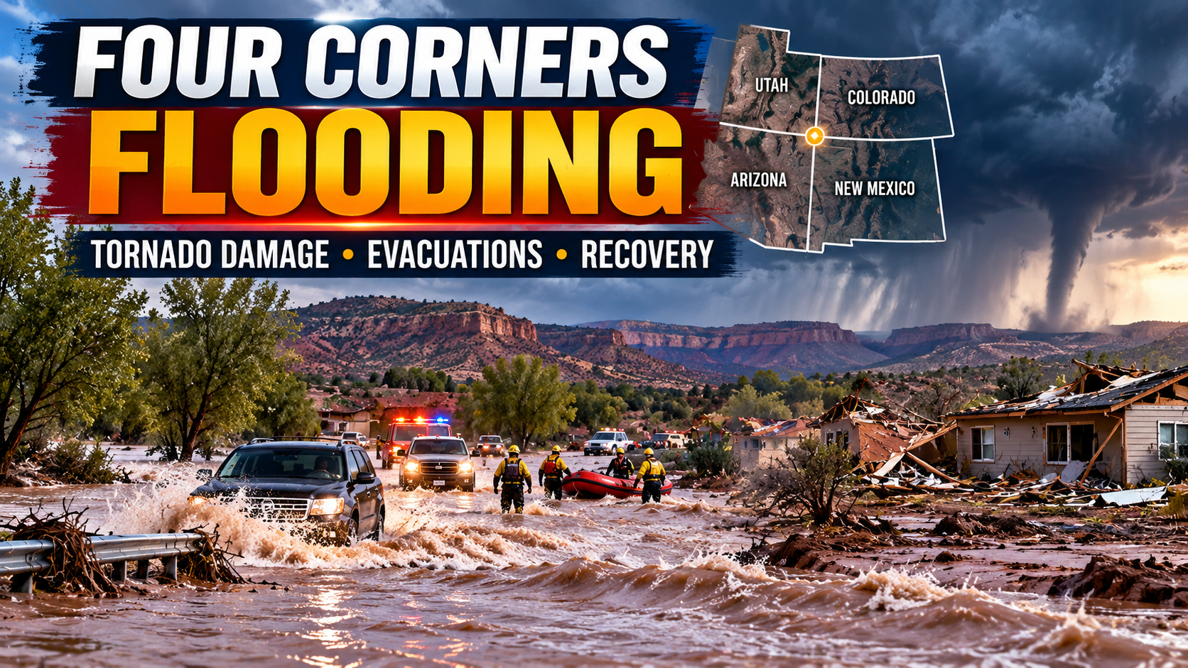
Severe Flooding and Tornado Damage Across the Four Corners Region
Severe Flooding and Tornado Damage Across the Four Corners Region: Families Evacuated as Communities Face a Difficult Recovery (October 26, 2026)
Updated: October 26, 2026 · Based on reporting and National Weather Service information available Monday morning
Communities across Arizona, Colorado, New Mexico and Utah are assessing severe flooding and storm damage after days of unusually heavy rain, swollen rivers and at least one confirmed tornado touchdown in New Mexico. Floodwaters forced evacuations, prompted rooftop and water rescues, damaged homes and roads, and disrupted power and wastewater systems. Even where rivers have begun to recede, officials say the danger does not end when the water level drops.
The emergency has shifted from the first rush of rescues toward a difficult mix of evacuation management, safety inspections, utility repairs, contamination concerns and damage assessment. As of October 26, the National Weather Service said broader flood watches in parts of the region had expired, but a flood warning remained in effect along the San Juan River in southeastern Utah through early Tuesday, with high flows expected to continue through late Monday.

1. What happened across the Four Corners region?
The Four Corners is the area where Arizona, Colorado, New Mexico and Utah meet. A prolonged period of heavy rain intensified during the week of October 19, with the heaviest impacts reported from Wednesday, October 21, onward. Rains fell on ground already saturated by weeks of intermittent wet weather, sending muddy water into homes, roads, campgrounds, businesses and river corridors.
The San Juan and Animas rivers rose sharply around Farmington and Bloomfield in northwestern New Mexico. Flooding spread along the San Juan River corridor and into parts of the Navajo Nation, while southern Colorado communities including Archuleta County and the Pagosa Springs area also faced major flooding and road closures. Utah communities were dealing with earlier inundation as the weather system continued to affect the broader region. Arizona had already experienced storm damage and tornado reports earlier in the week.
Emergency crews used boats, helicopters, amphibious vehicles and other rescue equipment to reach people trapped by rising water. Some residents were rescued from rooftops or from vehicles and homes surrounded by floodwater. In Farmington and nearby communities, evacuation instructions affected hundreds of households, while the wider number of people impacted was estimated at around 2,000 in and around the city in reporting published over the weekend. Officials were still assessing the number of damaged homes, so a final regional damage count was not available in the sources reviewed.
By Sunday, October 25, some rivers had begun to recede, but the emergency had not ended. In New Mexico, officials carried out welfare checks and house-to-house inspections to identify hazards before evacuees could return. In Colorado and Utah, high river flows, damaged roadways and ongoing warnings continued to complicate movement and recovery.
| Region | Reported impacts | Situation described by October 26 |
|---|---|---|
| Northwestern New Mexico | Flooding along the San Juan and Animas rivers, evacuations, water rescues, power outages and damage to homes and infrastructure. | Some water levels receded, but many residents remained evacuated while officials checked structures and utilities. |
| Navajo Nation / Shiprock area | Flooding affected homes and roads; wastewater facilities and holding ponds were damaged, with sewage released into the San Juan River. | Authorities were assessing impacts and potential contamination; exact release volumes had not been determined in the AP report. |
| Southwestern Colorado | Serious flooding, road closures and damage in Archuleta County, Pagosa Springs and river communities. | Officials were assessing the extent of damage; AP reported no injuries or deaths in Archuleta County as of Sunday evening. |
| Southeastern Utah | High flows and major flooding along the San Juan River, with impacts near Aneth, Montezuma Creek and Bluff. | The NWS Grand Junction office said a flood warning remained active through early Tuesday, with flooding expected to continue through late Monday. |
| Arizona | Earlier storms caused roof damage, downed trees and power lines, with tornadoes or suspected tornadoes reported. | Forecasters and local officials continued to document damage from the week’s storms. |
The regional headline brings together several connected but distinct hazards: river flooding, flash flooding from intense rainfall, tornado damage and the long tail of infrastructure disruption. Conditions are not identical in every town, and an expired flood watch in one area does not mean every river, road or neighbourhood is safe.
2. Timeline: how the flooding and storm response unfolded
The crisis developed over several days rather than in a single short storm. The timeline below summarises events described in local, state, federal weather and news reports. Exact evacuation boundaries and warning periods changed as conditions evolved; residents should use current county alerts, not a timeline in a news article, for immediate decisions.
| Date | Key development | Why it mattered |
|---|---|---|
| Wednesday, October 21 | Heavy rain intensified across parts of the Southwest, with storm damage reported in Arizona, including roofs, trees and power lines. | Saturated soils and repeated rainfall increased the potential for rapid runoff and flash flooding. |
| Thursday, October 22 | Floodwaters rose in Utah and Colorado and along the San Juan and Animas rivers in New Mexico. Communities issued evacuation guidance and closed roads; Utah’s Hurricane area declared an emergency after widespread inundation. | Water rescues, road closures and emergency declarations moved from local problems to a multi-state response. |
| Friday, October 23 | Farmington-area households were told to evacuate; rescue crews used boats, helicopters and amphibious vehicles. More than four inches of rain had fallen in parts of the region since Wednesday, with over five inches reported in some locations in later accounts. | Rivers surged into homes and roads; officials warned that more rain could worsen flooding downstream. |
| Saturday, October 24 | Flood recovery continued, but additional storms and another surge of water remained concerns. A tornado touched down in Santa Fe around 7 p.m. local time. | Emergency operations had to address both water damage and wind-related structural damage. |
| Sunday, October 25 | Floodwaters were receding in some parts of New Mexico, but residents remained evacuated and hundreds were without power. The NWS maintained a flood watch for much of the Four Corners region; major river flooding continued farther downstream. | The focus increasingly included inspections, utility hazards, contamination and the safety of returning residents. |
| Monday, October 26 | The NWS Grand Junction office said broader flood watches had expired at midnight, but a San Juan River flood warning in southeastern Utah remained active through early Tuesday. | Conditions were improving in some locations but remained hazardous along parts of the river and in damaged neighbourhoods. |
Early reports described the rainfall as unusually heavy after two months of on-and-off rain had ended a summer drought in parts of the region. The weather service warned that saturated ground can cause even additional, relatively modest rainfall to send creeks and streams over their banks. The main operational challenge became tracking the timing of downstream river crests while checking homes and infrastructure already damaged.
NWS Albuquerque forecast office ↗
National Weather Service alerts ↗

3. New Mexico: Farmington, Bloomfield and the San Juan River corridor
Northwestern New Mexico was one of the main centres of the flooding emergency. The San Juan and Animas rivers rose rapidly, sending water into residential areas and low-lying properties around Farmington and Bloomfield. Some residents watched the water level rise in a matter of minutes, and emergency crews rescued people who had become trapped in homes or on rooftops.
Reporting from October 24 and 25 described around 2,000 people affected in and around Farmington and hundreds of households told to evacuate. Those figures refer to different measures: people affected by the broader emergency are not the same as the number of households ordered to leave. Local officials said they did not yet have a definitive total for damaged homes or everyone who had evacuated.
Even as the river started to fall, local leaders urged residents not to return too soon. Downed power lines, possible gas and propane leaks, damaged buildings, silt, mud and floodwater contamination could remain after the visible water receded. Officials were going house to house to inspect properties, a process expected to take several days in some locations.
Power and utility outages
Hundreds of residents were reported to be without electricity on Sunday. Flooding can damage utility poles, electrical equipment, service connections and underground infrastructure, while debris and weakened ground may make repair access difficult. A neighbourhood with lower water levels may still be unsafe if power lines are down or if gas equipment has shifted or broken.
Residents should avoid touching fallen wires, standing water around electrical equipment, or damaged gas lines. Report hazards to emergency or utility services and follow official instructions before entering a home or reconnecting power. If a building smells of gas, residents should leave the immediate area and contact emergency services from a safe location rather than operate switches or attempt repairs.
Damage to homes and personal property
Floodwater can damage foundations, walls, insulation, floors, appliances, vehicles and private wells, and it can leave behind silt and contaminants. Fast-moving water can also carry tree trunks, fencing, fuel containers and other debris that may damage structures. Some damage is not obvious from the outside, especially where water has entered crawl spaces, basements, walls or electrical systems.
Residents who are allowed to return should document damage with photographs from safe locations, keep receipts for emergency spending, and contact their insurer or landlord. They should not enter buildings that officials have declared unsafe or attempt to move heavy debris while water remains high or structures appear unstable.
Local recovery assistance
Local reporting said San Juan College planned to open a disaster recovery centre in Farmington on Monday, October 26, to connect affected residents with assistance. Emergency shelters and daytime support locations were also being used in the area; their availability and hours can change, so residents should verify details through San Juan County, the city, the college or official emergency-information channels before travelling.
4. Navajo Nation and Shiprock: flooding, wastewater damage and river concerns
Flooding also affected communities in and around the Navajo Nation, including the Shiprock area. Local and tribal response teams carried out rescues as roads and homes became inundated. Earlier reporting said emergency teams rescued seven families, about 30 people, from flooded homes in Dennehotso, Arizona, using specialised vehicles and working with tribal emergency services and Arizona responders.
In the Shiprock area of New Mexico, flooding damaged wastewater facilities and water-holding ponds, leading to sewage releases into the San Juan River, according to a Navajo Tribal Utility Authority official quoted by the Associated Press. As of Sunday’s report, officials did not know exactly how much sewage had reached the river. That uncertainty is important: a known wastewater failure can create a contamination concern even while the full geographic extent and concentration of pollution are still being assessed.
Why wastewater damage matters
Flooding can overwhelm treatment systems, damage pumps and electrical components, move untreated sewage through broken pipes, or inundate facilities that normally keep wastewater separate from rivers and drinking-water infrastructure. If sewage enters a river, it may introduce pathogens and create risks for people, animals, irrigation and downstream water use. The scale of risk depends on what was released, how much entered the water, river flows, treatment-system status and any sampling or public-health guidance.
Residents should not infer that every tap-water supply is unsafe simply because a wastewater facility was damaged, but they should follow any local boil-water notice, drinking-water advisory or closure issued by tribal or county authorities. They should also avoid swimming, wading, fishing or allowing pets and livestock into floodwater or river sections under an advisory, and should not collect water for drinking from streams or wells affected by floodwater without official guidance.
Tribal and local coordination
The response involves multiple agencies with different responsibilities, including the Navajo Nation, local chapter communities, Navajo Police, emergency-management personnel, public-utility operators, state agencies and federal partners. Tribal lands and communities may rely on distinct alert systems and local services. Readers should look for the notice from the authority responsible for their exact community rather than assume that a county-level update covers every Navajo Nation location.
Flooding along a large river also affects downstream communities even if the worst rain has stopped upstream. Water can take time to move through a drainage basin, and flood crests may reach one location after conditions improve in another. This is why officials were continuing to watch San Juan River levels downstream through southeastern Utah.
Navajo Tribal Utility Authority ↗
NWS river and flood information ↗

5. Colorado: high river flows, road closures and a difficult damage assessment
In southwestern Colorado, flooding affected Archuleta County, the Pagosa Springs area and communities connected to the San Juan and Animas river systems. Local officials closed roads where water crossed the pavement or damaged bridges and road surfaces. The town of Pagosa Springs and the Archuleta County Sheriff’s Office issued urgent travel advisories on October 22, warning motorists to avoid major flooded sections of U.S. Highway 160 and not to drive through standing or moving water.
In its October 25 report, the Associated Press quoted Archuleta County Sheriff Mike Le Roux describing the destruction as catastrophic. Teams were carrying out welfare checks and aerial surveys to understand the extent of the damage. As of Sunday evening, the Colorado incident-management spokesperson said no injuries or deaths had been reported in Archuleta County, but the damage assessment remained incomplete.
Road closures can outlast the storm
Roads may remain closed after rain stops because floodwater can wash away road shoulders, undermine a bridge approach, leave rocks and trees across a route, or damage culverts and drainage systems. Even when the pavement looks passable, water may have eroded the ground underneath it. A road reopened to local traffic may still have weight limits, restricted access or nearby hazards.
Drivers should check current Colorado Department of Transportation information, county road notices and local law-enforcement updates before travelling. Follow barricades and detours, and do not drive around a closure. Emergency responders must be able to reach affected homes, and private vehicles entering a damaged road can create new rescue calls.
Impacts on tourism and outdoor recreation
The Four Corners region includes river corridors, campgrounds, rafting routes, parks, scenic drives and rural lodging businesses. Flooding can damage campgrounds and recreational-vehicle sites, close rivers and trails, make access roads unsafe and leave debris in waterways. An area outside the worst flood footprint can still be affected if its main road or utility connection is closed.
Visitors should confirm directly with parks, outfitters, campgrounds and local authorities before attempting to return to a reservation. A cancellation policy or a travel route may change quickly when road access and utility service are uncertain. Avoid rafting, boating or hiking in flood-affected river corridors until authorities and operators say conditions are safe.
Colorado Department of Transportation ↗
Archuleta County official site ↗
6. Utah: flooding continues downstream along the San Juan River
The National Weather Service’s Grand Junction office issued an update at 12:12 a.m. MDT on Monday, October 26, saying the broader flood watches had been allowed to expire at midnight. The office also said the flood warning for the San Juan River in southeastern Utah remained in effect because flooding had been reported along the river. The warning was set to continue until 6 a.m. MDT on Tuesday, October 27, and the forecast discussion expected high flows to persist through late Monday.
The warning covered parts of western Montezuma County in southwestern Colorado and southern San Juan County in southeastern Utah, including areas near Aneth, Montezuma Creek and Bluff. The NWS warned of major flooding along the river and said the crest was expected to move through downstream communities. Such forecasts can be updated as upstream flows, additional precipitation and river observations change.
Why water can keep rising after rain eases
River flooding does not always peak where the rain falls or at the same time the storm passes. Runoff from tributaries and mountain slopes can converge into larger rivers, then travel downstream over many hours. A downstream community can therefore face a rising river even when the sky above it is clear and the upstream weather watch has expired.
This is why the status of a flood watch and a flood warning should not be treated as interchangeable. A watch signals that conditions may lead to flooding; a warning indicates flooding is occurring or imminent in the specified area. An expired watch does not cancel a separate warning that remains active for a river or location.
Residents should follow the current NWS warning text and instructions from local emergency managers. If an evacuation is ordered, leave promptly using official routes and do not cross flooded roadways. Never attempt to walk or drive through moving water; depth and current strength can be difficult to judge, and a relatively shallow flow can sweep away a person or vehicle.
View active San Juan River warnings ↗
Check current NWS alerts ↗
7. Tornado damage adds another layer to the disaster
The flooding emergency coincided with tornado-related damage in the region. The Associated Press reported that a tornado touched down in central Santa Fe, New Mexico, around 7 p.m. on Saturday, October 24. It damaged homes, including roofs, knocked down trees and left debris in neighbourhoods. Meteorologists were investigating reports of other possible twisters, but no final damage estimate was available in the Sunday report.
Earlier in the week, storms in Arizona also produced tornado reports or suspected tornadoes, with roofs damaged, trees brought down and power lines affected. At least one injury was reported in the earlier Arizona storm coverage. The storm sequence therefore involved more than water damage: wind-related structural failures and falling trees created separate hazards that could remain after floodwater receded.
Flood and tornado damage can overlap
A house may be affected by floodwater at ground level while also having a damaged roof, broken windows or fallen trees from strong winds. Utility lines can be downed by both water and wind. A structure that appears intact from the street may have compromised roof supports, electrical connections or a weakened foundation. Residents should let local inspectors and utility professionals assess conditions before attempting extensive cleanup.
What storm damage inspectors look for
- Roof and structural damage: Missing roofing, cracked walls, shifted foundations, broken framing or signs that parts of the building may collapse.
- Electrical hazards: Downed lines, water in electrical panels, damaged service meters and submerged outlets or appliances.
- Gas and propane risks: Broken supply lines, moved tanks, damaged regulators or the smell of gas inside or around a building.
- Debris and trees: Unstable limbs, partially uprooted trees, sharp material, scattered roofing and hidden objects beneath mud.
- Contamination: Sewage, chemicals, fuel and other substances that can enter floodwater or remain in mud and damaged structures.
Residents should not climb onto roofs to inspect damage, cut trees near power lines or enter buildings that officials have marked unsafe. Photograph damage only from places judged safe, and use trained contractors or public-response teams for hazardous repairs.

8. Why the danger can persist after floodwaters begin to recede
Floodwater can retreat quickly from a street while leaving behind hazards that are harder to see. Mud and silt make surfaces slippery, drainage channels may remain blocked, and structures may have been weakened by prolonged water exposure. Floodwater can also carry sewage, fuel, agricultural chemicals and household products into yards, crawl spaces and nearby waterways.
Saturated ground and additional rainfall
Forecasters said unusually heavy rainfall since Wednesday had fallen on already wet ground. The wider area had experienced on-and-off heavy rain for roughly two months, according to AP reporting. When soil is saturated, a new downpour has less capacity to soak into the ground and more water runs across the surface into streams, washes and rivers. This can lead to renewed flooding even after an earlier crest begins to fall.
The National Weather Service’s October 26 update said the weather system was moving out to the northeast, with generally drier conditions forecast Monday through Thursday in the Grand Junction forecast area. It nevertheless warned that San Juan River flooding would continue into late Monday and retained a flood warning through Tuesday morning. A drier forecast does not make a river that is already above flood stage immediately safe.
Contaminated water and sewage
Officials warned that floodwater in San Juan County could contain chemicals and raw sewage. A damaged wastewater system on the Navajo Nation led to sewage releases into the San Juan River, although the amount released was not known in the AP report. People should avoid contact with floodwater and heed any water-use advisories from local, county, state or tribal authorities.
After contact with floodwater, wash exposed skin with soap and clean water as soon as possible. Use bottled or otherwise officially approved drinking water if authorities issue a notice. Keep children and pets away from floodwater, mud and debris, and do not let pets drink from rivers or flooded yards. Anyone who develops symptoms after exposure should contact a healthcare professional and mention the floodwater exposure.
Downed lines and gas leaks
Standing water can hide electrical cables, damaged electrical equipment or broken utility connections. Treat every downed power line as energised and stay well away. Do not touch a person, vehicle or object in contact with a line, and call emergency services or the utility from a safe location. If a building has a gas smell, leave immediately and avoid operating electrical switches or ignition sources near it.
Roads, bridges and low-water crossings
Flooding may undermine roadbeds and bridges or leave deep mud and debris after water has passed. Barricades can mark areas where the visible surface does not reveal the structural hazard. Follow official detours, do not drive around closed-road signs and do not attempt to cross flooded washes. “Turn around, don’t drown” is a practical safety rule: a driver cannot reliably judge water depth, speed or road damage from the driver’s seat.
9. The recovery challenge: housing, utilities, clean-up and local services
Once immediate rescues are complete, recovery often becomes a slower and more complicated task. Officials have to find out which homes can be reoccupied, restore power and water, clear roads and drainage channels, evaluate bridges, inspect wastewater infrastructure and connect displaced families with temporary accommodation. Each part can depend on another: crews may need road access to repair a utility, but the road may remain closed until the river drops; a homeowner may need an inspection before returning, but inspectors must prioritise hundreds of affected addresses.
Housing and temporary accommodation
Evacuated families may be staying with relatives, in hotels or in shelters. Not every evacuee will register at a public shelter, so shelter occupancy alone does not reveal the number of displaced people. Households with children, older adults, disabilities, pets or medical equipment may need additional assistance to find suitable temporary accommodation.
Before returning home, residents should wait for official clearance for their specific address or evacuation zone. A broad notice that some floodwaters are receding does not override an evacuation order. If entry is allowed, go cautiously, avoid floodwater, use a flashlight rather than an open flame, and leave if there are signs of structural movement, gas odour, sparking or unusual sounds.
Power, water and wastewater systems
Power restoration requires crews to inspect damaged poles and lines and ensure equipment can be safely re-energised. Drinking-water and wastewater systems may need sampling, disinfection, repair or a period of controlled operation. Even if a household’s tap is running, residents should follow any advisory affecting that supply, and should not assume that an advisory for one community applies identically to another.
Small businesses, farms and tourism
Flooding can damage shops, restaurants, warehouses, farm equipment, livestock facilities, roads and recreation businesses. A business may face lost inventory, cleanup costs, cancelled bookings and lost customer access. Farms and rural properties may also have damaged fences, contaminated feed or water, damaged irrigation equipment and livestock losses. These effects can continue to influence local income after the visible emergency ends.
Insurance and documentation
Property owners and renters should contact their insurer or landlord and preserve records of damage and emergency expenses. Flood damage and wind damage may be covered under different policies or conditions; standard homeowners policies often treat flood coverage separately. The details depend on the policy, location and type of loss, so this article cannot establish a specific household’s coverage.
- Take photos or video from safe locations before moving damaged items where feasible.
- Make an inventory of damaged belongings and record approximate age and value if known.
- Keep receipts for temporary accommodation, supplies, cleanup and repairs.
- Do not discard potentially relevant records or receipts before contacting the insurer, unless keeping an item creates a safety hazard.
- Use licensed or appropriately qualified contractors and be wary of unsolicited high-pressure repair offers.
- Do not pay for promised disaster grants through unofficial links, gift cards or wire transfers.
State and federal assistance
New Mexico’s governor was preparing a request for a federal emergency declaration, and members of the state’s congressional delegation urged the president to declare an emergency to help release assistance funding. The request and any resulting declaration are separate steps. Residents should not assume that every person or property will automatically qualify for federal assistance; eligibility and the type of support depend on official declarations, programme rules and individual circumstances.
Colorado had declared an emergency in 11 counties earlier in the response, according to AP reporting. That is a separate state action and does not itself mean that federal disaster assistance has been approved for every affected area. Official state emergency-management channels are the best place to verify the current status of requests, grants and recovery resources.
FEMA official website ↗
Colorado emergency management ↗
10. Why the weather became so damaging
Meteorologists described the event as part of a prolonged stretch of wet weather affecting the Southwest, with moisture coming ashore from the Pacific and repeated rain saturating the ground. AP reported that forecasters thought El Niño may have contributed to the unusually heavy rainfall, although a single flood event cannot be attributed to one climate factor solely on the basis of that comment. The more immediate explanation for the flood impacts is clear: intense rainfall met saturated soils, swollen rivers and exposed communities along waterways.
Flash flooding versus river flooding
Flash flooding can develop rapidly when intense rainfall runs off slopes, streets or washes. It may overwhelm drainage systems or send a fast surge into a low-lying neighbourhood. River flooding can rise over a longer period as water from a large drainage basin converges downstream. The two can overlap: flash runoff adds to rivers, and high rivers prevent local drainage from emptying efficiently.
Why the Four Corners terrain matters
The region includes mountains, mesas, canyons, desert valleys and river corridors. Rain that falls in higher terrain can flow toward lower-elevation communities. Roads and homes along rivers, arroyos and low-water crossings can face rapid changes even when local rainfall is light. Narrow valleys may limit escape routes, and long stretches of rural road can delay access for emergency crews.
Why future rainfall forecasts still matter
When ground and river channels are already stressed, a new storm can produce impacts larger than its rainfall total might suggest. The NWS warned that even relatively small additional amounts could overflow small creeks and streams in saturated areas. That is why authorities asked residents to continue monitoring alerts rather than concluding that the danger had passed simply because the sky cleared.
Weather attribution and climate trends require separate evidence from event-specific response reports. This article attributes the immediate cause to the reported rain and river response, and treats broader climate explanations as context rather than as a definitive conclusion about one storm sequence.
11. What residents and travellers should do now
Emergency conditions differ by town and river basin, so the safest guidance is the instruction issued for the person’s precise location. A general news report can describe the situation but cannot replace a current evacuation notice, road closure or weather warning.
If you are in an evacuation zone
- Leave when authorities order an evacuation; do not wait to see whether the water reaches your property.
- Use the official evacuation route and avoid closed roads, low-water crossings and river access points.
- Take essential medicines, identification, phone chargers, important documents and supplies for children, older adults and pets if time permits.
- Tell a trusted contact where you are going when safe to do so.
- Do not return until local authorities explicitly lift the order for your area.
If your home has flooded
- Do not enter if officials have marked it unsafe, the structure has shifted, or water still surrounds it.
- Assume floodwater may be contaminated; use protective equipment and follow local health instructions during cleanup.
- Avoid electrical panels, wet appliances, damaged wiring, downed lines and gas equipment.
- Keep children and pets away from debris, mud, standing water and damaged wells.
- Document damage safely and contact your insurer or landlord.
If you are travelling through the Four Corners region
- Check current National Weather Service alerts and the state road agency before setting out.
- Expect detours and delays; allow emergency responders access to roads and incident areas.
- Never drive through moving or standing floodwater, even if another vehicle appears to cross.
- Do not enter rivers, streams or flooded recreation areas for photographs or outdoor activities.
- Keep drones away from rescue aircraft and do not approach active emergency scenes.
When to call for help
Call 911 for an immediate threat to life, a trapped person, a serious injury or an active hazard requiring urgent response. For routine information, shelter availability or road questions, use the relevant local information line or agency channel when available so emergency dispatchers remain free for urgent calls. Follow any instruction to keep non-residents away from incident zones.
12. Related weather and U.S. news coverage on USANowDay
Use these internal USANowDay links to find related coverage as the storm response and recovery continue. Topic-search pages may show newer articles as they are published.
13. Frequently asked questions
1. Which states are included in the Four Corners region?
The Four Corners is where Arizona, Colorado, New Mexico and Utah meet. The recent storm caused impacts across parts of all four states, although warnings and damage varied by location.
2. What caused the flooding?
Reports describe unusually heavy rain since Wednesday, October 21, falling on already saturated ground after weeks of intermittent wet weather. The rain caused rivers to surge and contributed to flash flooding in communities and road corridors.
3. Where were evacuations reported?
Evacuations were reported in low-lying areas along the San Juan River and around Farmington and Bloomfield in New Mexico, as well as in other affected communities. Evacuation zones change; residents should follow current local orders rather than rely on a general regional summary.
4. Were people rescued from rooftops?
Yes. Associated Press reporting described water rescues, including people trapped on rooftops, with crews using boats, helicopters, amphibious vehicles and other equipment in New Mexico and surrounding areas.
5. Was a tornado confirmed in New Mexico?
The Associated Press reported that a tornado touched down in Santa Fe around 7 p.m. on Saturday, October 24. Forecasters were investigating reports of possible additional twisters, and no final damage estimate was available in the report.
6. Did tornadoes also affect Arizona?
Earlier in the week, storms in Arizona produced tornado reports or suspected tornadoes and caused roof damage, downed trees and power lines. Earlier reporting said at least one person was injured.
7. Is the flooding emergency over now that water levels are receding?
No. The NWS Grand Junction office said on October 26 that broader flood watches had expired, but a San Juan River flood warning in southeastern Utah remained in effect through early Tuesday. Evacuated areas may also remain unsafe because of utility and structural hazards.
8. What risks remain after floodwaters go down?
Hazards can include downed power lines, broken gas or propane lines, unstable structures, road damage, contaminated water, mud and debris. Residents should wait for official clearance before returning and follow utility and public-health guidance.
9. Was the San Juan River contaminated?
A Navajo Tribal Utility Authority official told AP that wastewater facilities and holding ponds in the Shiprock area were damaged, causing sewage releases into the San Juan River. The AP report said officials did not know the amount released at that time. Follow local and tribal water advisories for current information.
10. How many people were affected?
Weekend reporting said around 2,000 people were affected in and around Farmington, and hundreds of households were told to evacuate. Officials did not yet have a final count of damaged homes or evacuees in San Juan County in the AP report.
11. Were deaths reported?
As of the Associated Press report on October 25, San Juan County officials said they were not aware of any deaths in that county. That statement should not be treated as a final casualty count for the entire four-state region; reports and official assessments can change.
12. What should drivers do around flooded roads?
Do not drive through standing or moving floodwater, and do not bypass barricades. Check current state and local road information, use official detours and allow emergency crews access to affected areas.
13. Is federal disaster assistance available?
New Mexico’s congressional delegation urged a federal emergency declaration, while the governor was preparing a request. A request is not the same as an approved declaration. Residents should check official state emergency-management and FEMA channels for current assistance status and eligibility.
14. Where can affected residents find current information?
Check the National Weather Service for warnings, county and city emergency-management pages for evacuation instructions, state transportation agencies for closures, and tribal authorities for Navajo Nation alerts and water-related notices.
14. Conclusion: the rescue phase is only the beginning
The late-October storms have left parts of the Four Corners region coping with multiple layers of damage: flooded homes, evacuated neighbourhoods, tornado-related destruction, road closures, power outages and wastewater concerns. Emergency responders carried out difficult rescues as rivers rose, and by October 26 some water levels were falling. But receding water does not immediately make an area safe or reveal the full cost of damage.
In New Mexico, officials were inspecting evacuated homes and warning residents about utility lines and contaminated water. On the Navajo Nation, authorities were assessing wastewater-system damage and potential effects along the San Juan River. Colorado communities faced road and structural damage, while a San Juan River flood warning remained active in southeastern Utah into Tuesday morning. Tornado damage in Santa Fe added a separate set of hazards and repair needs.
The next phase will depend on careful inspections, safe utility restoration, clean-water guidance, road repairs and the availability of local and state assistance. For residents and travellers, the most important principle is to follow official instructions for the exact location, remain away from floodwater and damaged infrastructure, and wait for authorities to clear evacuation zones before returning.
15. Sources and references
- Associated Press — “More flooding in Four Corners region after storms bring heavy rain and at least one tornado,” October 25, 2026. Reports on continuing evacuations, Santa Fe tornado damage, power outages, contamination concerns, Navajo Nation wastewater damage and Colorado impact assessments.
Read the AP update ↗ - Associated Press — “Rooftop rescues and evacuations as severe flooding soaks Four Corners region,” October 23, 2026. Early reporting on water rescues, road closures, evacuations and rainfall across the four states.
Read early AP flood coverage ↗ - National Weather Service Grand Junction — Area Forecast Discussion, issued 12:12 a.m. MDT October 26, 2026. Current regional forecast context: San Juan River flooding continuing through late Monday; broader flood watches expired at midnight; warning remained active into Tuesday morning.
Read the October 26 forecast discussion ↗ - National Weather Service Grand Junction — San Juan River flood warning. Details for the warning area in southwest Colorado and southeast Utah, including communities near Aneth, Montezuma Creek and Bluff.
View the flood warning ↗ - Utah Public Radio / KANW New Mexico Public Radio — “Flash floods force evacuations across the Four Corners,” October 23, 2026. Reporting on evacuation activity, flood alerts, water rescues and the regional response.
Read public-radio coverage ↗ - New Mexico Office of the Lieutenant Governor — “Historic flooding hits San Juan County as National Guard, State Police carry out rescues,” October 24, 2026. State-government update on evacuations, emergency operations and river levels.
Read New Mexico’s official update ↗ - Town of Pagosa Springs / Archuleta County — urgent Highway 160 flooding advisory, October 22, 2026. Local road closures and safety instructions for the Pagosa Springs area.
Read the local road advisory ↗ - National Weather Service — Flood safety. Practical guidance for avoiding flooded roads and responding to flood hazards.
Read NWS flood safety guidance ↗ - USANowDay — weather and disaster coverage. Internal topic searches for follow-up coverage as recovery information changes.
Search USANowDay for Four Corners updates ↗